ROMAN FOUNTAIN OF SAN PETER OF VILLAFÁFILA

|
ROMAN FOUNTAIN OF SAN PETER OF VILLAFÁFILA |
|
|
|
|
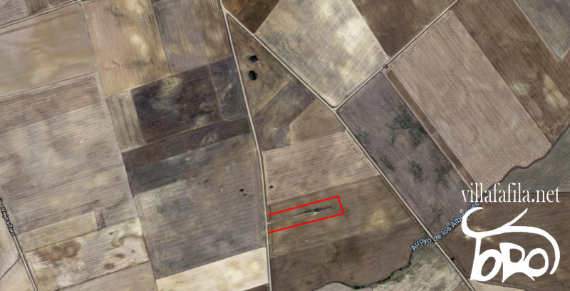
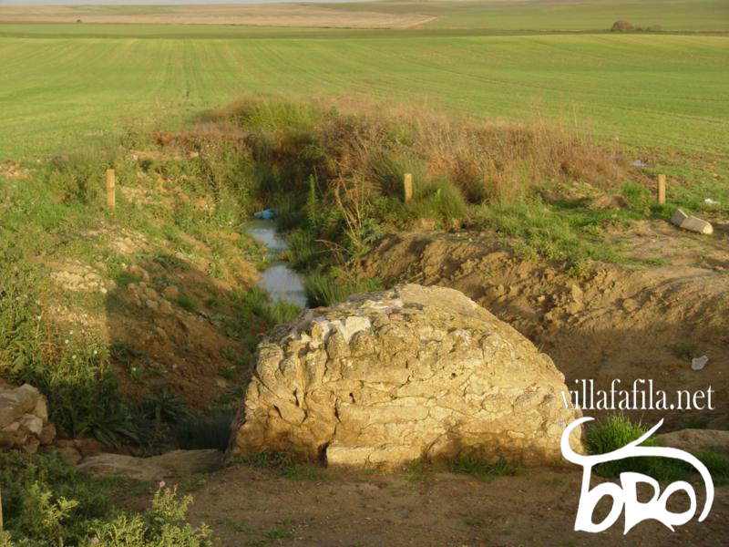
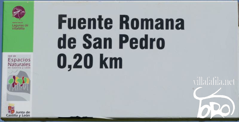
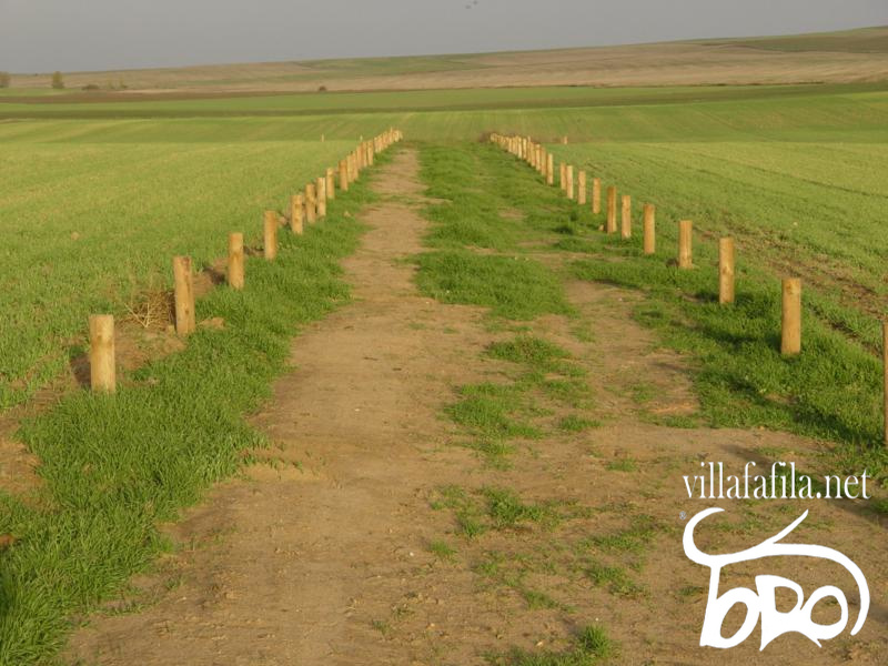
LOCATION It is located on an agricultural plot, which is reached by the path of the Vereda (Toro road), gives its name to the payment in which San Pedro is located, it is from Villafáfila approx. at 4.36 km, and from the Roman Villa of San Peter (mosaics) that are located in the same place about approx. 275 m after the Villa. Longitude: 41°48'54.3"N. Latitude: 5°34'38.0"W. https://goo.gl/maps/EhEaz6tH1tEYWZAD9
This source in the place that is found has been of vital importance for the cattle that grazed there and the people who traveled in the area doing agricultural work, or passing through on the way to Toro or neighboring towns.
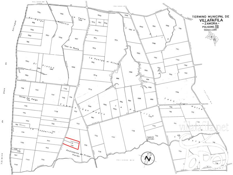
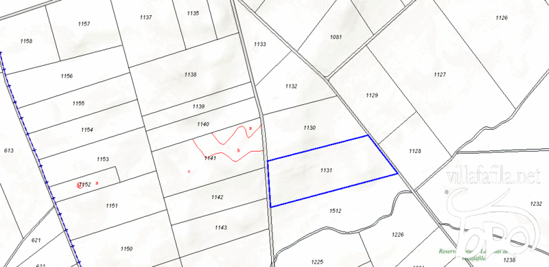
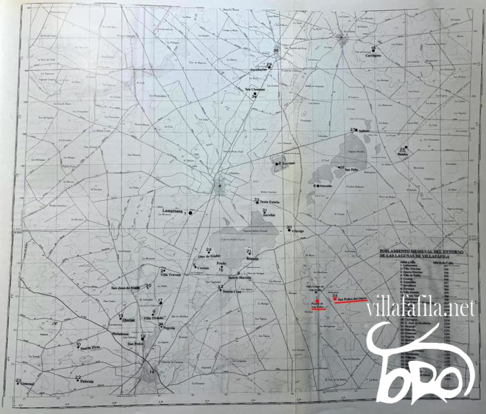
In the plot concentration map of Villafáfila, polygon 12, plot 1131.
Cadastral reference: 49271A001011310000FG. Location: Polygon 1 Plot 1131. REBLADALES OF THE PRIME. VILLAFAFILA (ZAMORA). Class: Rustic. Main use: Agricultural. Graphic area: 65,561 m 2 . Cultivation/Use: C-Labor or dry farming.
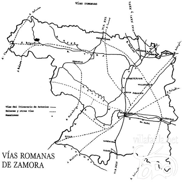
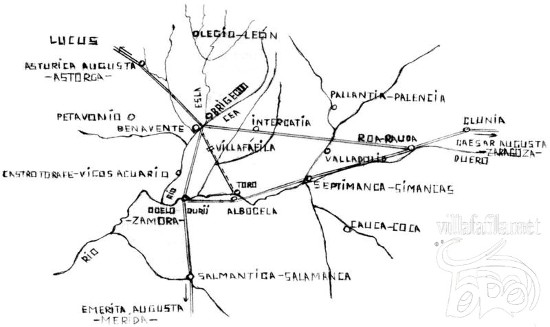
ACCESS ROAD Next to the Fountain of San Pedro ran a Roman road [1] of the second order, which was connected to each other with the Roman Bridge of Villarigo and the Villa Romana of San Pedro and which goes to : It joined the valleys of the Esla de Petavonium or Brigaecium (Benavente) passing in the direction of the Roman Bridge of Villarigo, saving the Villafáfila lagoons, it communicated with the settlement of the late Roman town of the Fuente de San Pedro and with the Fuente de San Pedro itself. until you get to connect with the Duero in (Albocela-Toro). This road was later a Vereda, the so-called Vereda de Benavente a Toro. Centuries later, in 1129, "et to enter the bull's race" is cited in the delimitation of the alfoz de Castrotorafe, granted by Emperor Alfonso VII of Castile. The influence that this secondary Roman road has had on the transhumance of sheep since the Middle Ages through the Plateau (Vereda de Benavente a Toro and Medina de Campo) should be highlighted, joining the Vía de la Plata or Vizana with the western Cañada Leonesa, which ran through the last of the indicated localities.
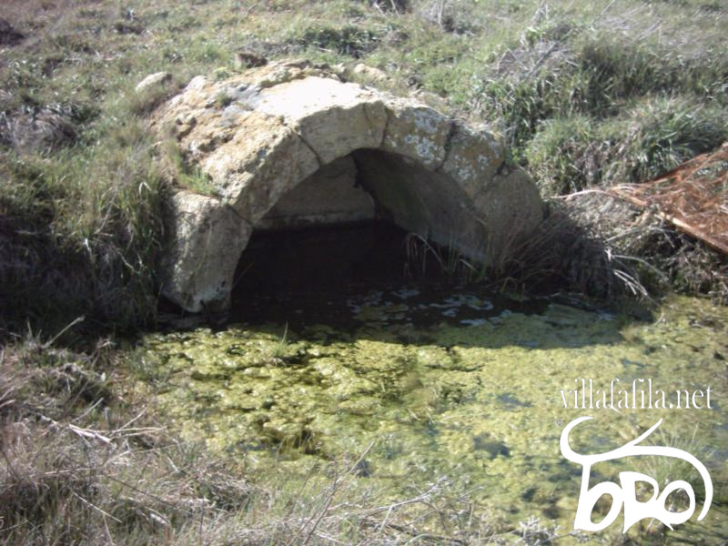
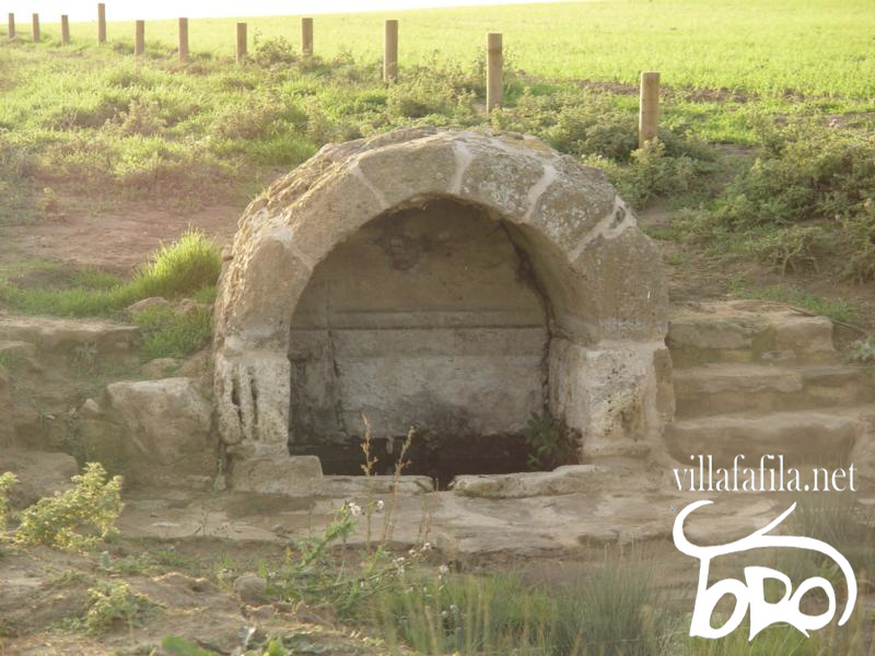
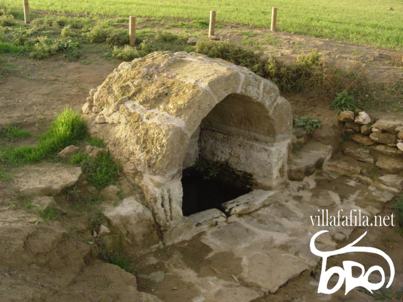
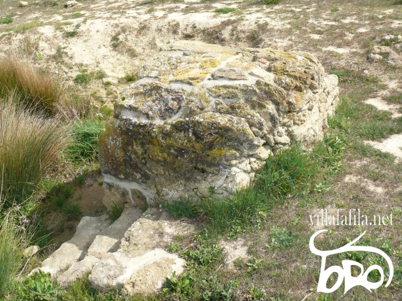
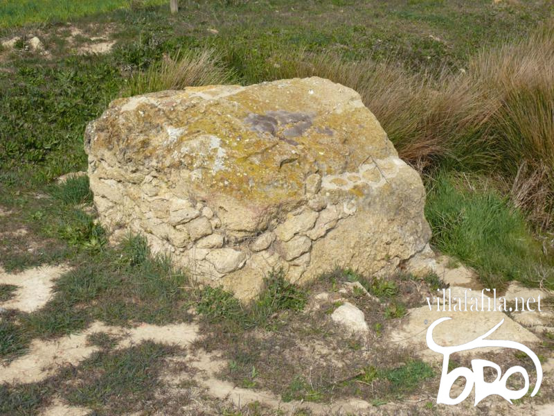
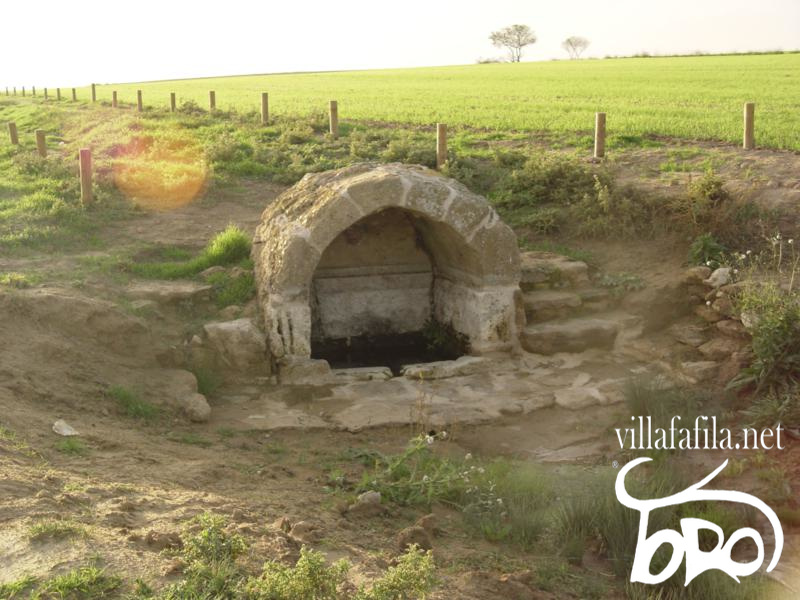
DESCRIPTION It is a Roman Fountain from the High Empire (27 BC to 284 AD), it is from the same period as the Roman Bridge of Villarigo. It is a spring that sprouts water and is covered by stone ashlars.
It has a rectangular floor plan, covered by a barrel vault and built with strong ashlars, which has survived intact to this day.
RESTORATION 2006
At least since 2006 the fountain was restored and its surroundings have been repaired by the JCyL through the Lagunas de Villafáfila Natural Reserve and the place is cleaned up every year. Its entrance from the path of the Vereda (Toro path) has been indicated with a fountain sign and even its location has been delimited with wooden posts to make it easier for people to visit.
It is currently restored respecting its originality and well preserved.
POPULATION In the vicinity of the Villa de la Fuente de San Pedro, there was a population about approx. 650 m to the east, called San Pedro del Otero, of which between its term was the place that was located the Roman Fountain of San Pedro as the Villa of San Pedro.
SAN PETER OF OTERO Although its church belonging to the Villafáfila cillero is not documented until 1310: “... Church...of San Pedro del Otero...”, from which the bishop received two buckets of salt as a tithe [2] , the remains that appear in its surroundings date from the 11th century according to ceramic finds, such as the remains of turned pots with incised grid decoration. Since the end of the 15th century, a term from Villafáfila has been named San Pedro del Yermo, which indicates a reference to depopulation and in 1522 the memory of the tower of the old church in one of the commander's lands is mentioned: " That is said the land of the tower of San Pedro boundaries on the way to Cañiço ...". As a sign of the old lordship, in 1498 the “ Palaçio iron ” persisted , in the form of a Rollo. Since then it is easy to identify the payment of "San Pedro del Yermo" in La Loma, including the Fuente de San Pedro, in the boundaries and surveys of the land. Its location is detected in one of the mounds or mounds to the north of the Cañizo road, where remains of tiles, slabs, ceramics and bones, separated from the Roman site, can be seen. Its location somewhat away from the lagoons raises the question of the place where they would extract the salt that they were obliged to deliver to the Bishop of Astorga. Two possibilities are pointed out: either that their terms reached the Laguna del Triunfo, or that they had the collective property of some inn on the banks of the Salina. His term would end up being included within the term of Villafáfila. Author: Jose Luis Dominguez Martinez.
Bibliography - Text:
Manuel de la Granja Alonso: The art of a Castilian-Leonese town, Villafáfila. p.11, 12, 13.
Elias Rodriguez Rodriguez: History of salt mines in the Villafáfila lagoons. P. 28, 30, 37, 52.
https://www.sedecatastro.gob.es
Maps of Parcelaria Concentration, Agriculture and Livestock of JCyL. https://www.jcyl.es/web/jcyl/AgriculturaGanaderia/es/Plantilla100Detalle/1246464862173/ACU/1207034696075/CParcelaria
Jose Luis Dominguez Martinez: Personal information.
Photography and maps: http://sigpac.mapa.es https://www.google.es/maps https://www.sedecatastro.gob.es Elias Rodriguez Rodriguez: Medieval settlement of the region of the Villafáfila lagoons according to medieval documentary sources. Manuel de la Granja Alonso. Plan of plot concentration of Villafáfila, polygon 12. https://agriculturaganaderia.jcyl.es/web/jcyl/binarios/312/862/VILLAFA_ACU_PLA_012.TIF?blobheader=image%2Ftiff&blobheadername2=site&blobheadername3=Cache-control&blobheadername4=Expires&blobheadervalue2=JCYL_Agricultura no-store%2Cno-cache%2Cmust-revalidate&blobheadervalue4=0 Jose Luis Dominguez Martinez.
Measurements: http://sigpac.mapa.es https://www.google.es/maps
Transcription and montage: Jose Luis Dominguez Martinez.
All text, photographs, transcription and montage, the rights belong to their authors, any type of use is prohibited without authorization.
All text and photography has been authorized for storage, treatment, work, transcription and assembly to José Luis Domínguez Martínez, its dissemination on villafafila.net, and any other means that is authorized. |